Ready or Not, Here We Go!
Jennifer Ronda
Since this was most likely the last "training" hike before our trek up Mt. Whitney, we wanted a hike that would give us one final challenge. And I think this one did it!
We headed to Mt. Tamalpais State Park, and the first part of the day was spent on Temelpa Trail, which was less like a trail and more like a very dried-up narrow creek bed. This trail had close to a 2,000 foot elevation gain and was a fairly direct route right up to the east peak and summit of Mt. Tam. Phew, that got us sweating!
We had a bird's eye view from the summit: we could see boats in the bay that were lining up for one of the America's Cup races, the tip of the Golden Gate Bridge, Mill Valley, across the bay to Mt. Diablo, and we even had a clear view of the Farrallon Islands! So we know the visibility on this day was at least 25 miles!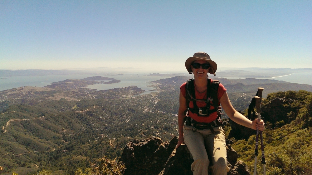 On the Mt. Tamalpais Summit, with the Bay Area and Pacific Ocean in the background
We then headed for the north side of Mt. Tam, taking the...wait for it... Northside Trail. This relatively flat and shady trail was a nice break after coming up the Temelpa Trail.
Next, we branched off Northside Trail to take Colier Spring Trail. And basically climbed up what was equivalent to a 50-story building! While short in distance, this trail took us up from about 1,800 feet to 2,300 feet. And no, there was no elevator to take us to the top.
Finally, Miller Trail to Hogback Fire Road which were mostly downhill. Hey, we need practice hiking downhill, too!
Total mileage: about 9 miles.
If we're not ready for Mt. Whitney at this point, I don't think we ever will be!